
East at 5 to 10 knots.
Slight with a wave height of 1 to 3 feet.
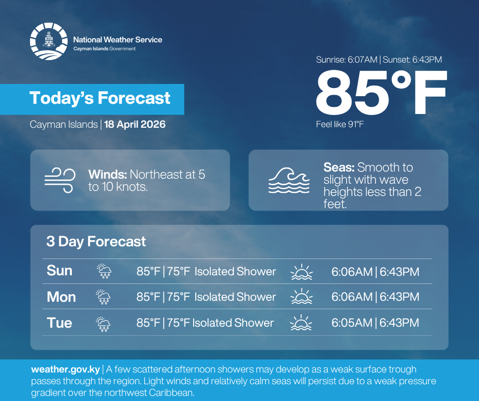
Issued on 18th April 2026 at 6:00 a.m.
VALID FOR THE MORNING OF 18th APRIL 2026
THROUGH THE MORNING OF 19th APRIL 2026
SYNOPSIS:
A few scattered afternoon showers may develop as a weak surface trough passes through the region. Light winds and relatively calm seas will persist due to a weak pressure gradient over the northwest Caribbean. Current radar imagery indicates isolated showers around the Cayman area moving towards the west to southwest.
FORECAST:
Today: Partly cloudy skies with a 30% chance of afternoon showers. Temperatures will rise near the mid to upper 80’s °F, with a hear index of 94 °F. Winds will be northeast at 5 to 10 knots. Seas will be smooth to slight with wave heights less than 2 feet.
Tonight: Mainly fair skies with a 20% chance of showers. Temperatures will fall near the upper 70’s °F. Winds will be southeast 5 knots or less. Seas will be smooth to slight with wave heights less than 2 feet.
TIDES:
Today: High 9:21 a.m. Low 3:58 p.m. High: 10:50 p.m.
Tomorrow: Low 4:47 a.m. High 10:08 a.m. Low 4:45 p.m. High: 11:43 p.m.
SUNSET: 6:43 p.m. Today. SUNRISE: 6:06 a.m. Tomorrow.
OUTLOOK: is for similar conditions through Tuesday morning.
Forecaster
Ebanks