
Overview
In 2022, the UN Secretary-General launched a global initiative to ensure that everyone on Earth is protected by an early warning system by 2027. The World Meteorological Organization is leading this charge by promoting impact-based forecasting—a system designed to provide more useful and actionable information to help people prepare for hazardous weather.
In alignment with this initiative, the Cayman Islands National Weather Service (CINWS), in collaboration with Hazard Management Cayman Islands (HMCI) and the Department of Communications (DoC), has enhanced its weather forecasting and warning systems. This new approach adheres to international standards and best practices, ensuring that the Cayman Islands receives accurate, timely, and easy-to-understand weather information.
The upgraded system focuses on clear communications and actionable alerts, helping the public to better understand what to expect, where, when, and what steps to take in response.
What You’ll Learn From CINWS Alerts
- Every alert issued will clearly communicate:
- The main weather conditions expected.
- The expected impacts on the Cayman Islands.
- When will the conditions begin and how long will they last.
- The recommended to stay safe.
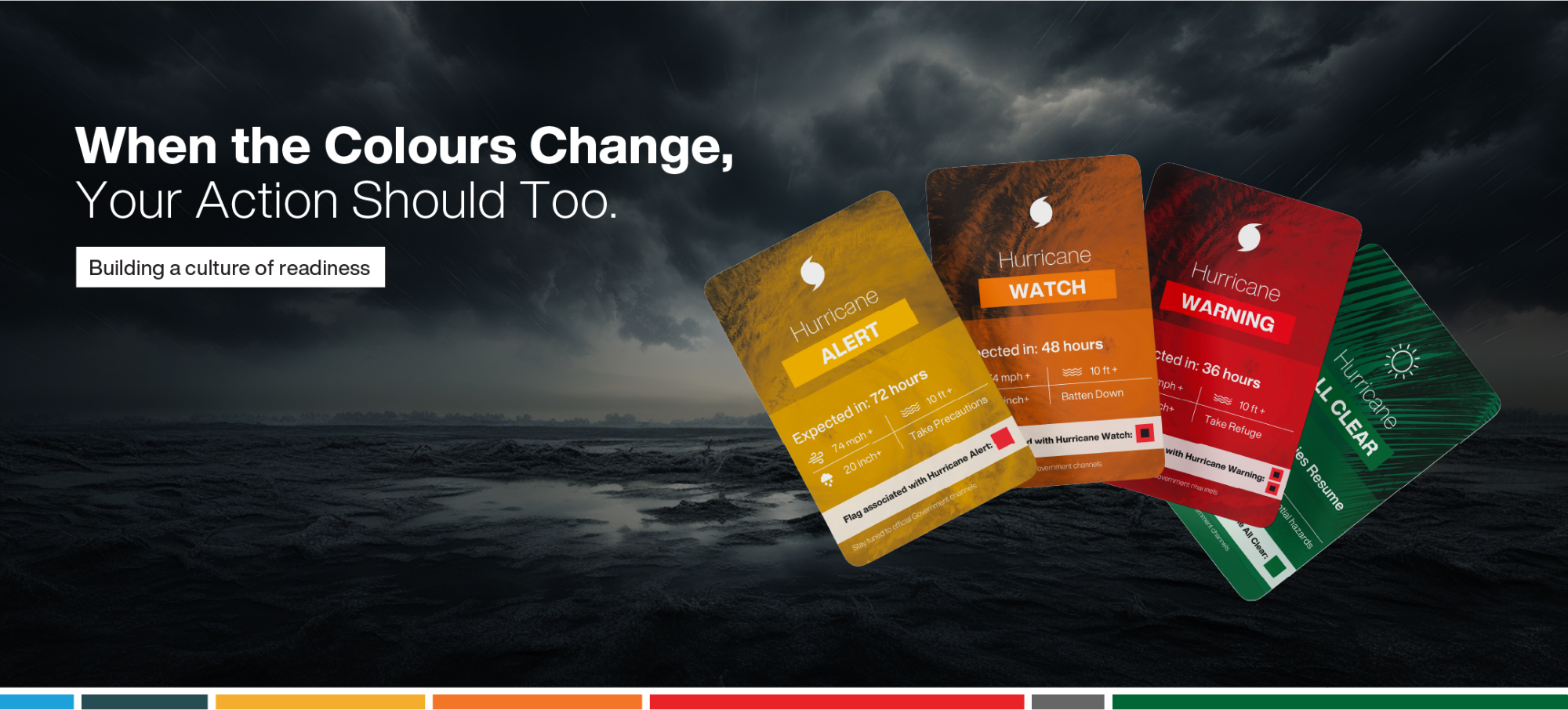
Alert Levels
The CINWS has introduced a new tiered Weather Alert System—ranging from Advisories to Warnings—designed to reflect increasing levels of risk and potential impact to the Cayman Islands. This approach builds on the familiar structure used for tropical storms and hurricanes (Alert, Watch, Warning) and extends it to other significant weather events such as strong cold fronts (nor’westers), tropical waves, and heat risks.
Residents are encouraged to become familiar with this system, as it offers clearer guidance for a broader range of weather-related threats.
The thresholds guiding these alerts are outlined in the table below. Please note that this table will be periodically reviewed as we strive to strike the right balance between providing effective warnings and avoiding over-warning or false alarms.
Alert: Be aware
This means that the weather event could produce some minor moderate impacts. This might cause some minor interruptions to day-to-day activities. A lot of persons will most likely still be able to continue most activities, but might need to exercise caution depending on the type of alert.
Watch: Take precautions
A watch is issued when moderate impacts are anticipated due to a specific weather event or a combination of significant weather elements. These impacts may include heavy rainfall, gale-force winds, moderate flooding, or a mix of these conditions, potentially leading to travel disruptions and interruptions to day-to-day activities. Make adjustments to prepare for these potential impacts. Taking early precautions and staying informed will help reduce potential risks should the situation escalate.
Warning: Take action
A warning is issued when dangerous conditions are expected with a severe weather event. An event of this magnitude could lead to significant damages to infrastructure such as flooded roadways, downed trees or powerlines. Impacts at the level can sometime interrupt day-to-day activities. Taking the necessary action will be essential to reduce the risks associated with the event.
| WEATHER | ALERT LEVEL | CRITERIA |
|---|---|---|
| Rainfall | No Alert | No Flooding Expected |
| Flood Advisory | Potential for localised flooding | |
| Flood Alert | 2 – 4 inches / 24 hrs | |
| Flood Watch | Potential for > 4 inches / 24 hrs | |
| Flood Warning | Greater than 4 inches / 24 hrs | |
Marine – Wave Heights (Lowest Height) | No Alert | Less than 4 feet |
| Small Craft Advisory | 4 – 7 feet | |
| Small Craft Alert | 7 – 10 feet | |
| Marine Watch | 10 – 13 feet | |
| Marine Warning | > 13 feet | |
Heat Risk (Heat Index HI °F) | No Alert | Heat Index < 110 °F |
| Heat Alert | Heat Index: 110 – 112 °F | |
| Heat Watch | Heat Index: 113 – 115 °F | |
| Heat Warning | Heat Index > 116 °F | |
| Thunderstorms | No Alert | Low chance of thunderstorms |
| Thunderstorm Advisory | Moderate to high chance of thunderstorms | |
| Thunderstorm Alert | Scattered to numerous thunderstorms | |
| Severe Thunderstorm Watch | Widespread thunderstorms with potential for some becoming severe | |
| Severe Thunderstorm Warning | Severe thunderstorms expected | |
Dust (AOD/DuEx) | No Alert | < 0.15 |
| Dust Advisory | 0.15 - 0.25 | |
| Dust Alert | 0.25 - 0.35 | |
| Dust Watch | 0.35 - 0.45 | |
| Dust Warning | > 0.45 | |
Winds (Sustained or Frequent gusts)
| No Alert | Less than 22 knots |
| Strong Wind Alert | 22 - 27 knots | |
| Near-Gale Watch | 28 - 33 knots | |
| Gale Warning | Greater than 34 knots |
2026 Revision
What Action Should You Take?
Taking the right action based on the alert level is key to protecting life and property. To respond appropriately, consider the following:
- Risk: The likelihood of being affected by a weather event, depending on your exposure and vulnerability.
- Vulnerability: How exposed or susceptible a person, community, or property is to a weather hazard.
- Exposure: The chance that you or your property will be impacted by a hazard.
⚠️ Important: Recommended actions may vary by location and population. For example:
- A marine warning might only apply to boaters.
- A localized flooding alert could affect specific community.
- A hurricane warning could prompt national-level preparedness actions.
Everyone—whether individual, family, or business—should assess their specific risks and surroundings to prepare properly. Always allow enough time to secure your property and ensure safety.
Stay Informed. Stay Prepared.
For preparedness and mitigation tips, visit Hazard Management Cayman Islands at caymanprepared.ky